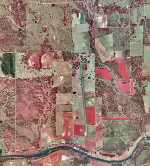
This photo is an infrared and aerial (overhead) view of a river valley in Texas. This area is part of the Lyndon B. Johnson National Park (ranch district). The infrared image colors help us determine which parts are certain agriculture regions, etc.
This is an aerial (overhead) black and white photography of an area in Delaware County, Pennsylvania. I found the website pretty interesting because they had the same aerial view photographed once in 1960 and then again 40 years later, in 2000. I used the most recent photo, taken in 2000.