 http://images.google.com/imgres?imgurl=http://www.geo.mtu.edu/volcanoes/central_america/nicaragua/cerro_negro/gvn/images/2012neg4.jpg&imgrefurl=http://www.geo.mtu.edu/volcanoes/central_america/nicaragua/cerro_negro/gvn/cerro_negro.v20n11_12.html&h=939&w=1499&sz=172&hl=en&start=5&sig2=uS5BJ7V2PAj6u-pUlqP6fg&um=1&tbnid=jYCyZTJt68LnSM:&tbnh=94&tbnw=150&ei=hqRiSObAHY_eigH28KisAw&prev=/images%3Fq%3Disopachs%26um%3D1%26hl%3Den%26rls%3Dcom.microsoft:en-us:IE-SearchBox%26rlz%3D1I7SUNA%26sa%3DN
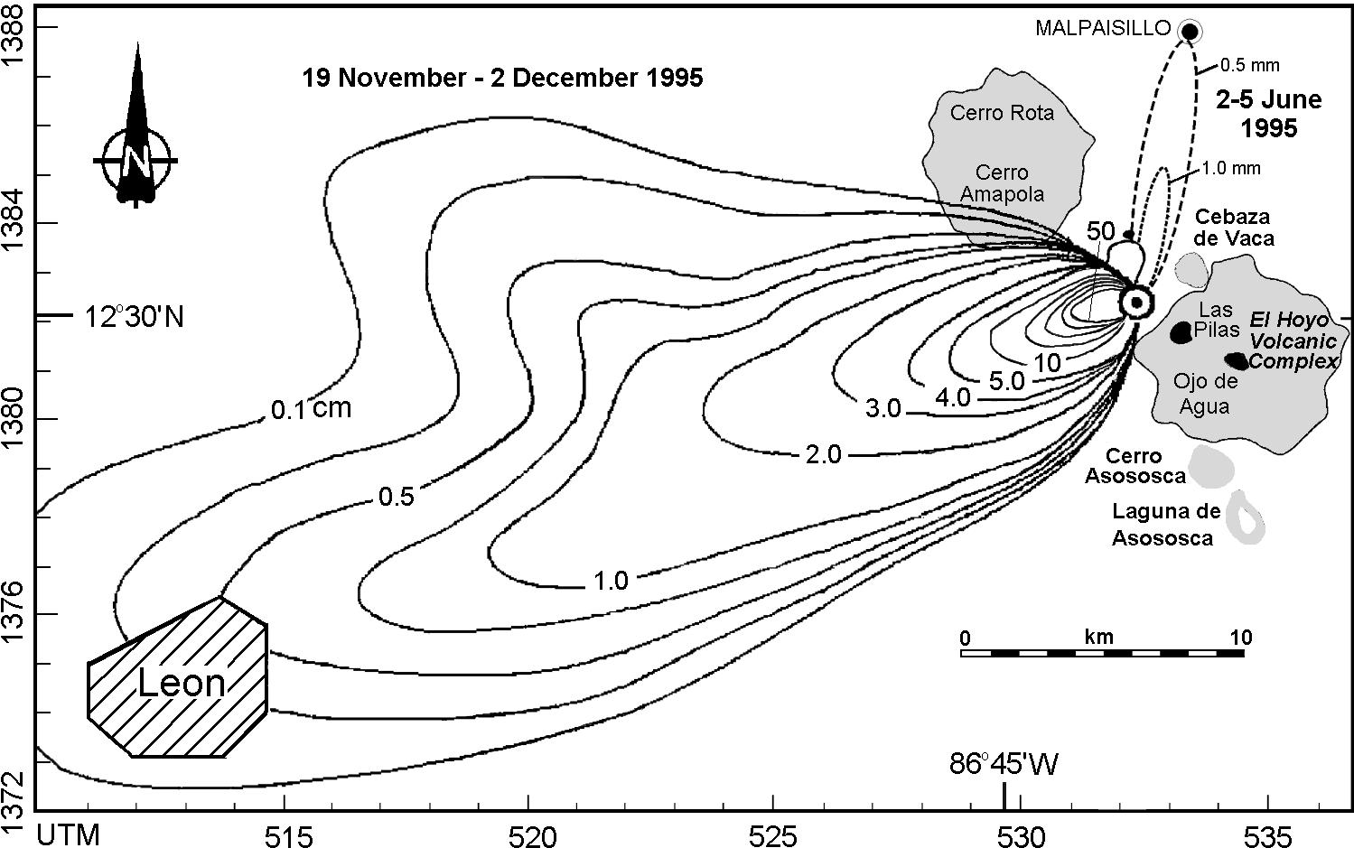
This type of map explains the rock or sediment thickness for the area shown by using contour lines. This map of Nicaraugua shows a central point with a large rock thickness- getting smaller the further you extend (due to a volcanic area).
No comments:
Post a Comment